Skip to content
UW Crest

Natural Resources Institute

Division of Extension

  • Focus Areas
    • Community Engaged Science and Education
    • Earth Sciences
    • Land and Forest Stewardship
    • Water Resource Management
    • Wildlife Ecology and Management
  • Programs
  • Resources
  • Professional Services
    • Evaluation
    • Instructional Design
    • Marketing and Communications
  • About Us
    • Our People
    • Our Blog
    • Extension Earth Fest Showcase
    • Stay in Touch
  • Donate
Search
University of Wisconsin-Extension

WGNHS researchers map major Wisconsin rock formation

Written by Samantha Klepfer Posted on January 28, 2025January 28, 2025
Share
  • Share:
  • Share on Facebook
  • Share on X (Twitter)
  • Share via Email
  • Copy Link

Copied!

The Maquoketa Group is a rock formation made up primarily of shale and can be found in southeastern Wisconsin. The formation lies between two of the area’s largest aquifers, working as a low-permeability barrier to water flow—stopping water from flowing freely between the aquifers. And, we don’t exactly know how big it is.

Helicopter for collecting airborne electromagnetic (AEM) data landing.
Helicopter, used for collecting airborne electromagnetic (AEM) data, as it lands. Photo Credit: Maureen Muldoon

Because it lies between two of the most important water sources in the area, mapping the Maquoketa shale is vital in knowing how that water moves underground, allowing land use planners to make more informed management decisions.

“We know the Maquoketa shale provides separation between the shallow Silurian dolomite aquifer and deeper aquifers along the entire eastern edge of Wisconsin,” WGNHS hydrogeologist David Hart said. “Knowing the degree of separation between these aquifers is important for many water supply questions.”

However, it’s a challenge to actually figure out the extent of this rock layer.

“The Maquoketa Group is entirely buried underneath younger layers of rocks and sediments, so we can’t directly observe it,” said Esther Stewart, a bedrock geologist at the Wisconsin Geologic and Natural History Survey (WGNHS) and principal investigator of the Maquoketa subsurface mapping project.

Calcite crystals lining a small cavity in the Silurian Dolomite core collected from above the Maquoketa Shale.
Calcite crystals lining a small cavity in the Silurian Dolomite core collected from above the Maquoketa Shale. Photo Credit: Pete Chase
Dark colored drill cuttings settling out of bentonite drilling mud.
Dark colored drill cuttings settling out of bentonite drilling mud. Photo Credit: Pete Chase

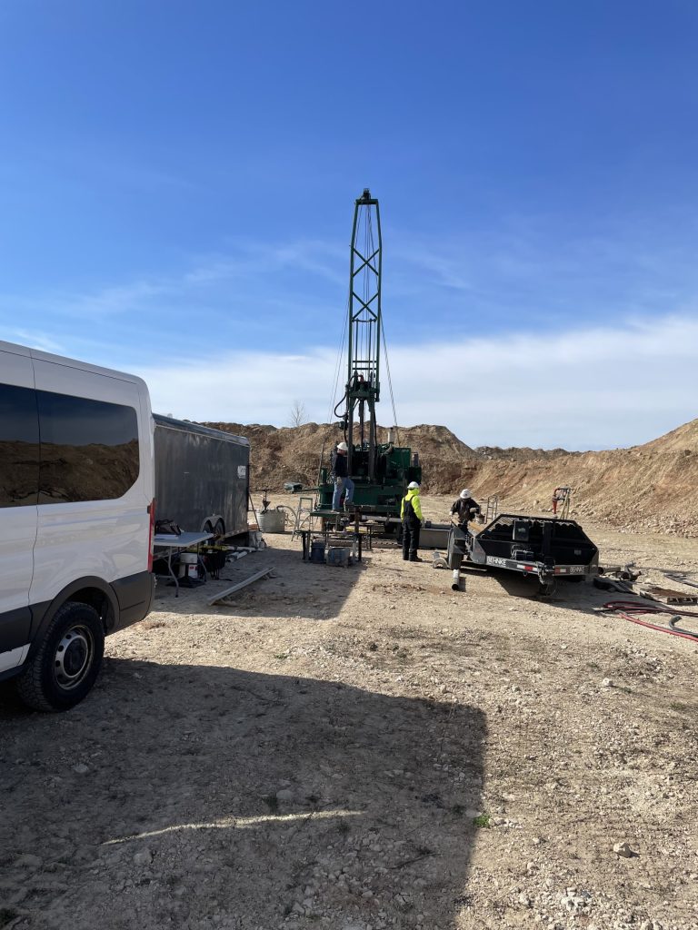
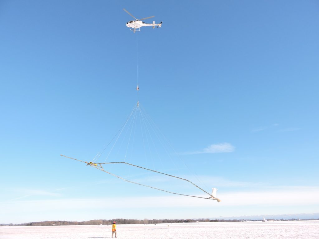
Stewart and a number of other WGNHS researchers are using a wide variety of techniques to map this hard-to-reach formation—gathering data from both the air and the ground, using a combination of wells and geophysics in order to define the borders and thickness of the shale. 

Hart works with the airborne electromagnetic (AEM) data, which was collected using a helicopter flying 200 feet off the ground, to measure how well the earth below conducts electricity. This can then help to differentiate areas with the Maquoketa shale from the aquifers.

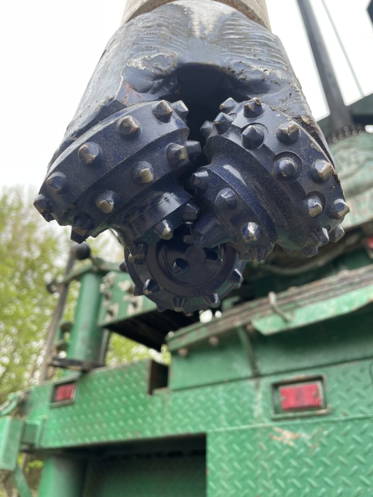
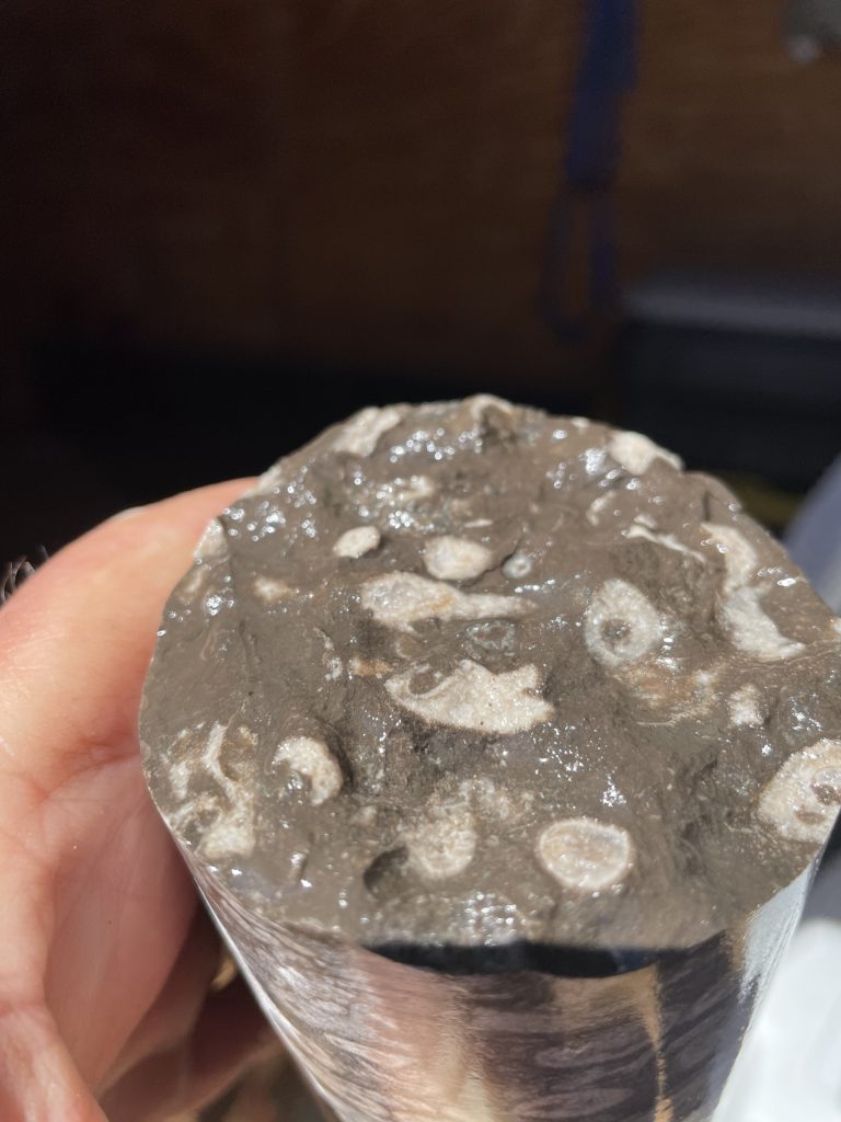
WGNHS compared this data with data gathered from the ground. “We know that shales are good conductors and dolomites are poor conductors,” Hart said. “We wanted to directly compare that electrical data to actual rocks, so Esther had rock cores drilled at locations where we had the AEM data.”

The collection of rock cores and borehole geophysical data was facilitated by WGNHS hydrogeologist Pete Chase. The data collected from the boreholes includes a variety of measurements, such as gamma radiation, flow velocity, and conductivity.

“All these logs help to characterize the lithology and groundwater encountered in the core hole,” Chase said. “That data is used to correlate between these two very well-documented core holes and other wells where we do not have core or even drill cuttings to examine.”

Using all of this information, WGNHS will be able to map the shale and paint a clearer picture of how vital water moves in the state of Wisconsin.

Tri-cone drill bit used for setting upper surface casing.
Tri-cone drill bit used for setting upper surface casing. Photo Credit: Pete Chase
Drill rig set up near Brant, WI. The drill pipe is on the right trailer, while supplies and shelter are in the left trailer.
Drill rig set up near Brant, WI. The drill pipe is on the right trailer, while supplies and shelter are in the left trailer. Photo Credit: Pete Chase
Fossil coral fragments which were locally common in the gray Maquoketa Shale core.
Fossil coral fragments which were locally common in the gray Maquoketa Shale core. Photo Credit: Pete Chase
Print This Page
Categorized: Special Topics

Division of Extension

Connecting people with the University of Wisconsin

  • Agriculture
  • Community Development
  • Health & Well-Being
  • Families & Finances
  • Natural Resources
  • Positive Youth Development

More Information

  • Home
  • About
  • Programs
  • Services
  • Blog
  • Donate

Follow NRI on Social

  • Facebook
  • Twitter

Stay Connected

  • Contact
  • Natural Resources Blog
  • Social Media Directory

For Staff

NRI Resource SharePoint
Internal Communications Blog

University of Wisconsin-Madison      |        Explore Extension: Agriculture Community Development Families & Finances Health Natural Resources Youth
Connect With Us
Support Extension
Extension Home

We teach, learn, lead and serve, connecting people with the University of Wisconsin, and engaging with them in transforming lives and communities.

Explore Extension »

County Offices

Connect with your County Extension Office »

Map of Wisconsin counties
Staff Directory

Find an Extension employee in our staff directory »

staff directory
Social Media

Get the latest news and updates on Extension's work around the state

facebook iconFacebook

twitter icon Follow on X


Facebook
Follow on X

Feedback, questions or accessibility issues: info@extension.wisc.edu | © 2026 The Board of Regents of the University of Wisconsin System
Privacy Policy | Non-Discrimination Statement & How to File a Complaint | Disability Accommodation Requests

The University of Wisconsin–Madison Division of Extension provides equal opportunities in employment and programming in compliance with state and federal law.